

Mundi Documentation
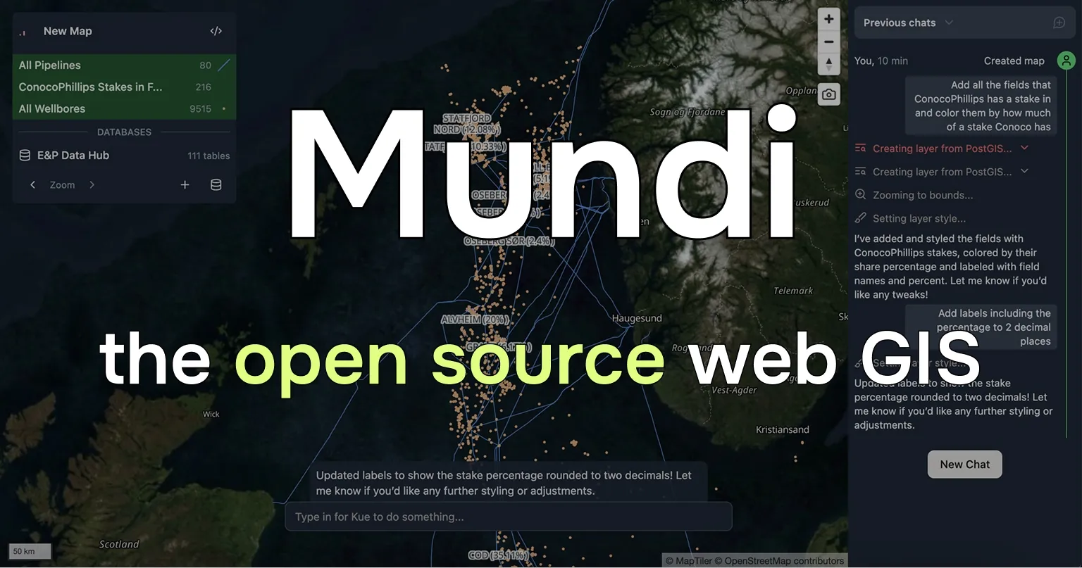
Mundi is an open source web GIS built around AI.
- Supports vector, raster, and point cloud data
- Connects to and queries spatial databases like PostGIS
- Uses LLMs to call geoprocessing algorithms and edit symbology
You can try it for free on Mundi cloud at app.mundi.ai,
our hosted cloud service. Mundi
is also self-hostable and open source under the AGPLv3 license, with full support for local LLMs.
Starting on Mundi cloud
Section titled “Starting on Mundi cloud”You can sign up for free at app.mundi.ai to try out Mundi and read some guides to learn what’s possible:
Using the Mundi developer API
Section titled “Using the Mundi developer API”You can use the Mundi API to create maps, upload spatial data, render maps, and more.
Self-hosting Mundi
Section titled “Self-hosting Mundi”Mundi is open source (AGPLv3) and can run entirely on your local machine with local LLMs.
We have a tutorial on self-hosting Mundi. Self-hosting requires a good computer/server, git, and Docker. You can optionally connect it to a local LLM (or any provider that supports the chat completions API).
Give us a star on GitHub, join our Discord to talk to us, or create a pull request to contribute back!