Segment Anything for Geospatial Data
You can run Segment Anything online in Mundi to extract polygons from aerial imagery, satellite imagery, and traditional maps. These polygons are already processed in Mundi and downloadable as vector spatial data (GeoJSON).
The Segment Anything tool available in Mundi uses Meta’s Segment Anything Model. To use the model, draw a bounding box around each object you want to segment. Once you have segmented everything, you can download the output as a GeoJSON.
You can access the Segment Anything tool online, and do not need to own a GPU or download any model. You can upload any imagery you need to segment or use our catalogue of imagery. Using the Segment Anything tool requires a Mundi subscription, starting at $45/month. There are sample locations with imagery loaded you can evaluate in Mundi.
Introduction to Segment Anything
Section titled “Introduction to Segment Anything”Segment Anything is a foundation model from Meta AI that predicts object masks given simple prompts such as points or boxes. We adapt Segment Anything for geospatial workflows by supporting GeoTIFFs and satellite imagery as inputs so that the polygons are already georeferenced, and by supporting GeoJSON exports that you can add to any GIS platform such as Mundi.
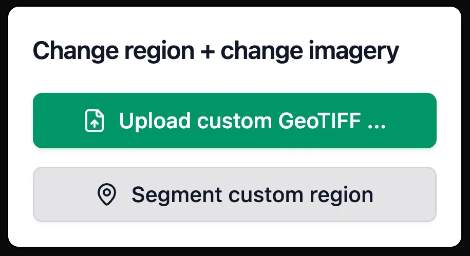
Adding data to segment
Section titled “Adding data to segment”You can upload your own GeoTIFF to the Segment Anything tool or work with our own catalogue of aerial imagery. Selecting your own region or adding your own imagery requires a Mundi Basic subscription. If you first want to evaluate the Segment Anything model, you can try our free public examples.
Free public examples
Section titled “Free public examples”You can evaluate the Segment Anything tool without a paid account using our sample imagery of popular targets. If you want to evaluate our tool on anything specific, email sales@buntinglabs.com
Upload your own GeoTIFF
Section titled “Upload your own GeoTIFF”Want to try custom imagery? You can upload any GeoTIFF and segment your own area of interest directly in your browser: https://app.mundi.ai/tools/segment-anything/geotiff
How to run the Segment Anything tool
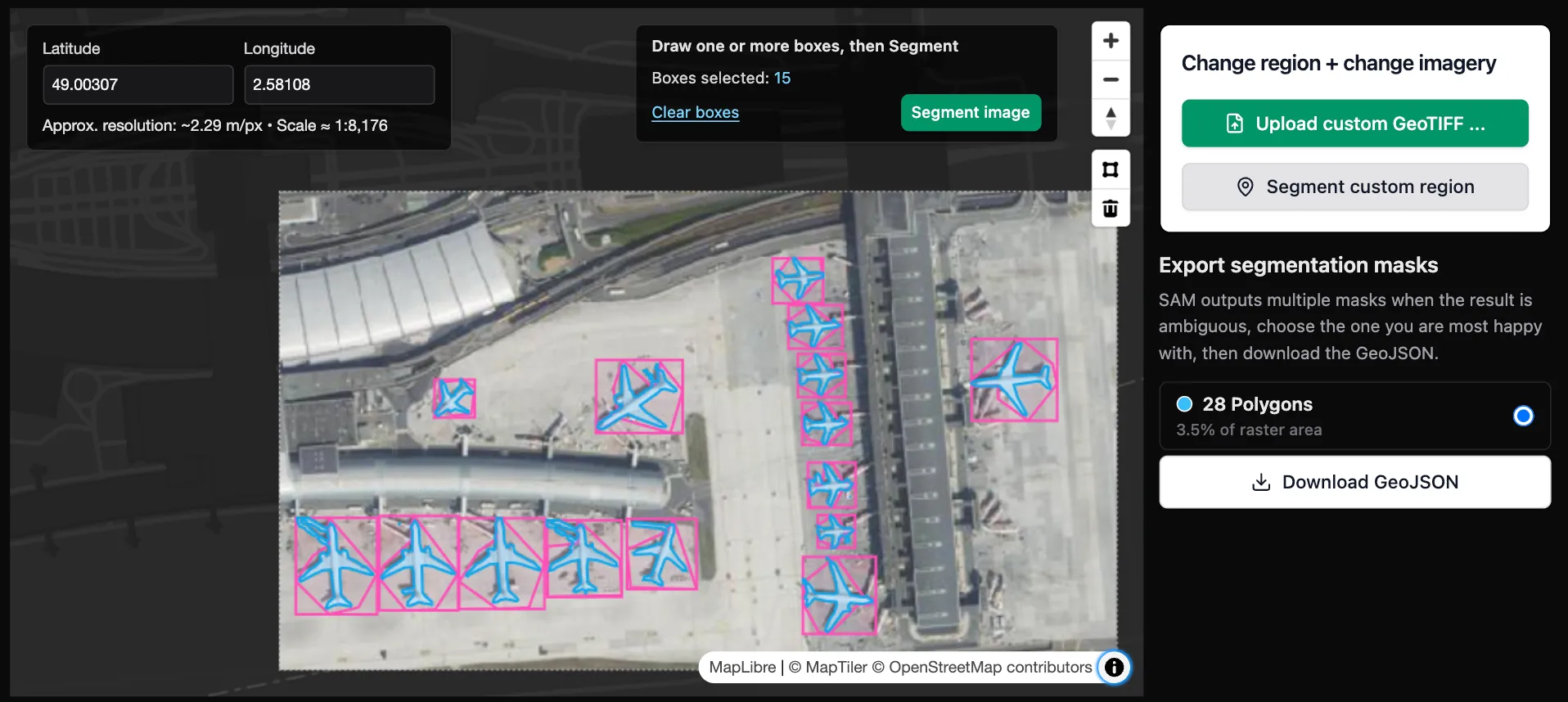
Section titled “How to run the Segment Anything tool”Unlike other Segment Anything applications, there are no downloads needed to run Mundi’s Segment Anything tool. You only need to find the imagery you want to segment, draw bounding boxes, and download your preferred result.
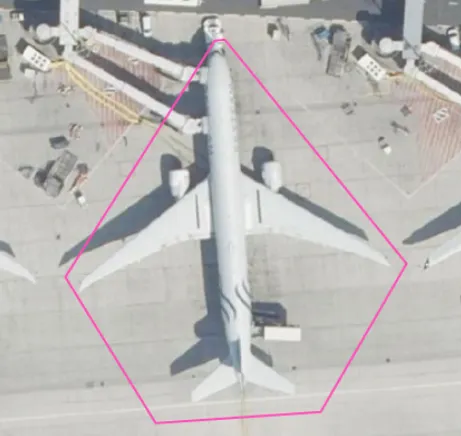
Unlike other applications of Segment Anything, this tool requires creating a bounding box around each target. We found that allowing the model to predict more targets led to much noisier results, requiring more cleanup time.
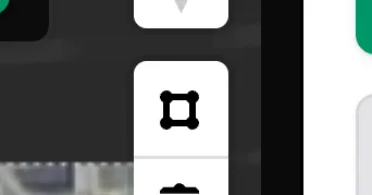
Select the bounding box tool
Section titled “Select the bounding box tool”To begin creating a bounding box, you need to select this icon. It will turn light grey when selected:
Draw a bounding box around each target
Section titled “Draw a bounding box around each target”Once the bounding box tool is active, left-click to create a bounding box. Make sure to keep the box close to your target. Once you are done, either double left click or right click to save the box. Once you save a box, the model will run.
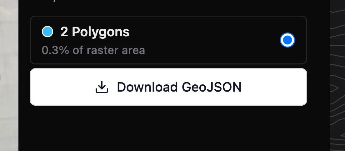
Save the output
Section titled “Save the output”Once you segment one target, you can either draw more boxes around more targets or download the polygons as a GeoJSON.
To download, select the Download GeoJSON button on the right side of the image.