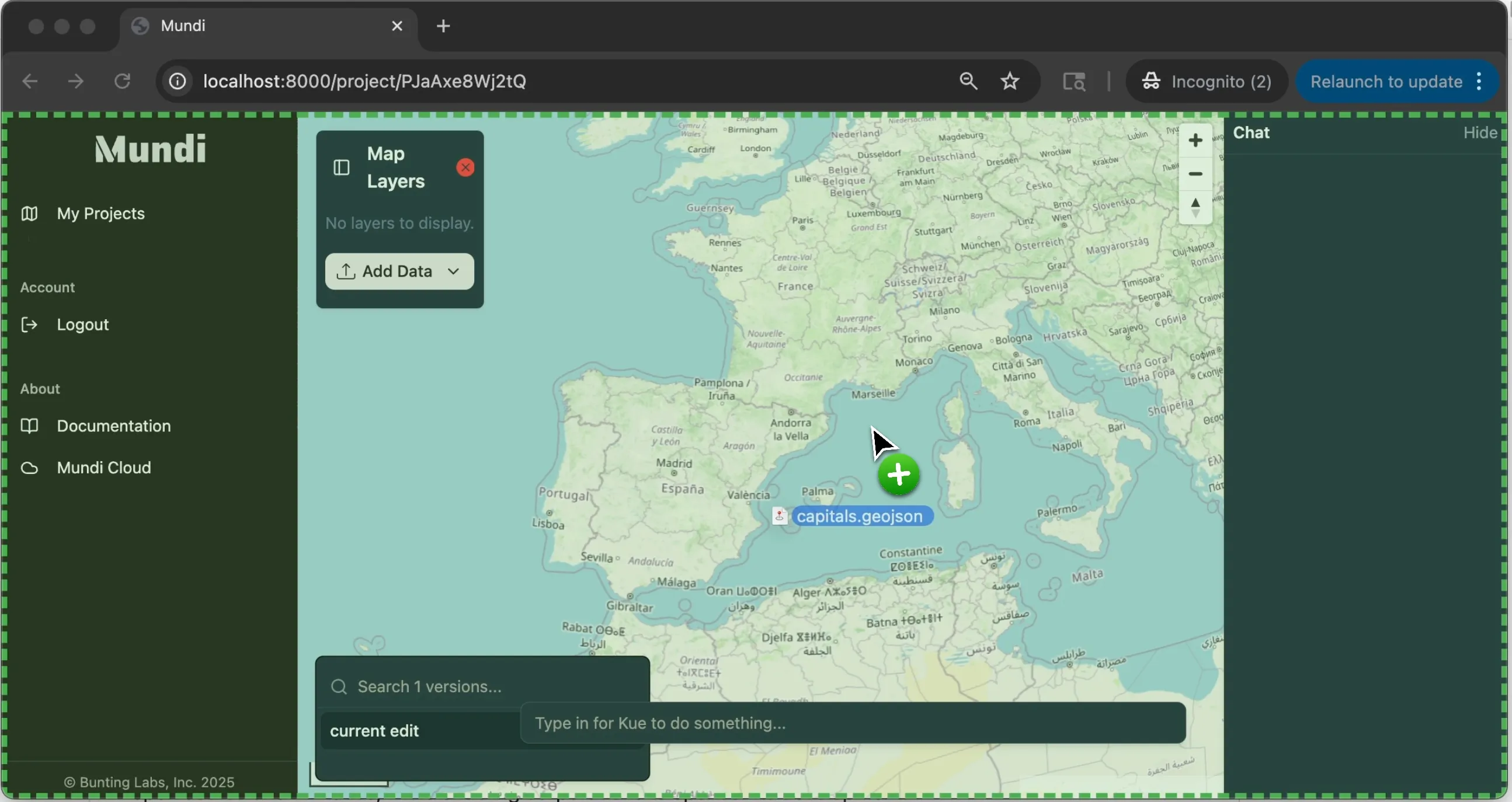
Uploading files to Mundi
Mundi supports most vector and raster file formats. You can also upload CSV spreadsheets and LAS/LAZ point cloud files.
Drag and drop a file directly onto the map to upload it to Mundi. You can also click on Add Layer Source > Upload file
in the layer list to open the file browser.

Uploading files can also be done via the Mundi developer API.
Vector spatial data
Section titled “Vector spatial data”Mundi supports FlatGeobuf (.fgb), GeoPackage (.gpkg), GeoJSON (.geojson), KML/KMZ (.kml, .kmz), and Shapefiles. Files in any CRS/projection
will work. Vector data is stored in its original CRS but is reprojected to Web Mercator (EPSG:3857) for display (tiles).
Other files supported by GDAL may work, but are not tested regularly. Create a new issue to request a new file format.
GeoPackage support
Section titled “GeoPackage support”Currently, Mundi will load the first layer in a GeoPackage file, and does not import styles embedded from QGIS. You will need to export the GeoPackage’s individual layers to load them all.
Shapefile support
Section titled “Shapefile support”To import a shapefile into Mundi, you should put the .shp, .dbf, .shx, and .prj files in a single ZIP archive
and then upload that to Mundi.
Raster data
Section titled “Raster data”Mundi supports GeoTIFFs (.tif and .tiff, includes COGs) and DEM (.dem)files. Only single-band and RGB data is supported. Single-band data
will be assigned a color map from its min and max values. Raster data is stored in its original CRS.
LAS/LAZ point clouds
Section titled “LAS/LAZ point clouds”Mundi supports .las and .laz point cloud uploads. Point clouds must have a CRS associated with them. Right now, point clouds
are loaded entirely into memory in the browser, so we highly recommend downsampling point clouds before uploading.
Spreadsheets (CSV)
Section titled “Spreadsheets (CSV)”Mundi accepts .csv files where each row represents a point. Your CSV must have a header row with column names
that separate out latitude and longitude columns with coordinates in WGS84 / EPSG:4326.
You can also connect directly to Google sheets.
For example, this CSV would successfully upload to Mundi:
name,yelp_score,lat,lngBeachside building,4.5,37.735482,-122.506563Yacht Club,4.7,37.850417,-122.531423Supported column names
Section titled “Supported column names”To detect and convert to spatial data, you must have latitude and longitude columns. The following column names are detected:
Latitude: lat, latitude, y, Y, Latitude, LAT, or LATITUDE
Longitude: lon, longitude, lng, x, X, Longitude, LON, or LONGITUDE
Geocoding addresses
Section titled “Geocoding addresses”Mundi does not currently support geocoding addresses in uploaded CSV files. If you have tabular data, like Excel spreadsheets,
CSVs, etc., we recommend you use geocodio or geoapify
to geocode the addresses first. This may require you to edit the headers in the resulting CSV so that latitude and longitude
columns exist.