Google Sheets
Mundi can directly connect to a link-accessible Google Sheet as a live data source. This is the most accessible way to manage point spatial data in a collaborative way for your team members. Using Google Sheets is advantageous to uploading CSVs because it updates over time and keeps the data as a single source of truth.
Preparing your Google Sheet
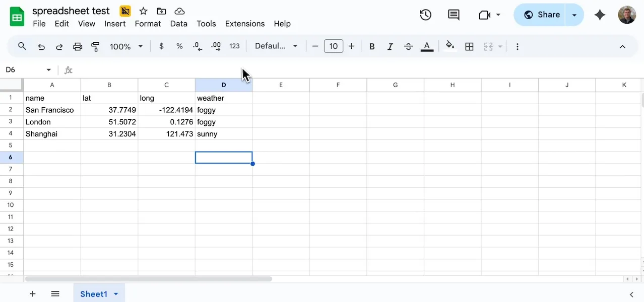
Section titled “Preparing your Google Sheet”Mundi automatically detects coordinate columns to create point geometries. Your sheet must contain separate columns for latitude and longitude.
Mundi recognizes common header names such as:
lat,latitudelon,long,longitude
Any additional columns in your sheet, like the weather column in this example,
will be imported as feature attributes, which you can use for styling and
analysis.
Link-accessible view access
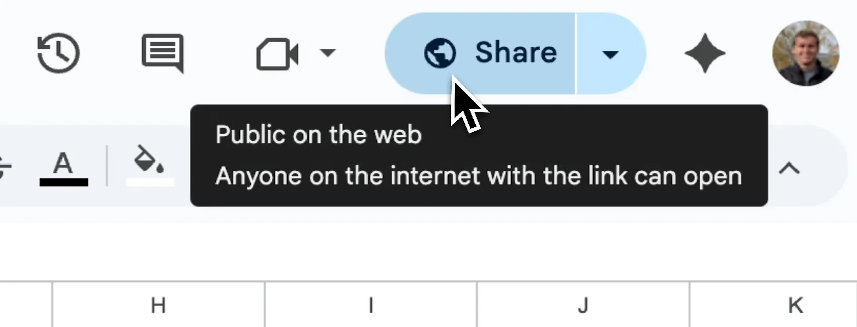
Section titled “Link-accessible view access”For Mundi to access the data, the Google Sheet must be publicly accessible.
In Google Sheets, click the Share button and set the General access to Anyone with the link and the role to Viewer. Mundi only needs read access to the sheet data.
Adding the sheet to Mundi
Section titled “Adding the sheet to Mundi”Once your sheet is prepared and publicly shared, you can add it to your map.
-
Copy the shareable URL from your Google Sheet’s address bar. Make sure this URL includes the specific sheet identifier (e.g.,
gid=0). -
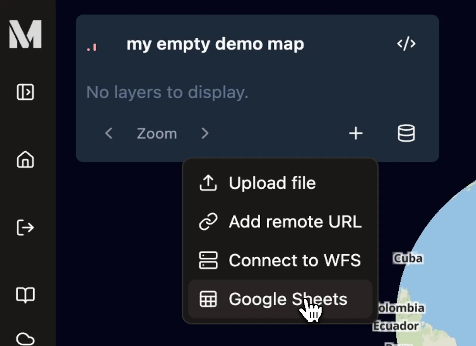
In Mundi, navigate to the Map Layers panel and click the Add layer source icon (the plus symbol).
-
Select Google Sheets from the dropdown menu.
- In the Connect to Google Sheets modal, provide a Layer Name for your new layer and paste the URL of your Google Sheet into the Google Sheets URL field.
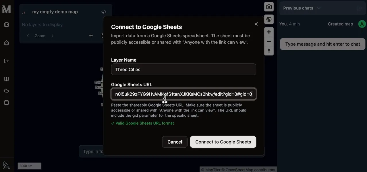
- Click Connect to Google Sheets. Mundi will fetch the data, parse the latitude and longitude columns to create point features, and add the new layer to your map.
3. Verifying the Data
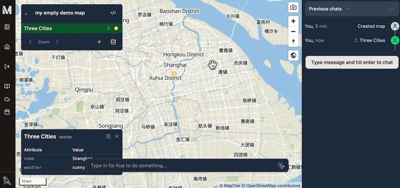
Section titled “3. Verifying the Data”After connecting, you will see the new points rendered on your map. The layer will also appear in the Map Layers panel.
You can inspect the attributes of any feature to confirm that all your data was
imported correctly. Zoom in and click on a point to view its attributes. As you
can see, the weather column from our spreadsheet is now an attribute of the
feature.
Your Google Sheets data is now a fully functional vector layer in Mundi. You can style it, use it in geoprocessing tools, or query it with Kue, Mundi’s AI assistant.