Adding data from a Web Feature Service (WFS)
Web Feature Services (WFS) are a standard way to share and access vector geospatial data over the internet. Mundi supports WFS sources, meaning layers in Mundi can continuously update to an external WFS server.
This guide demonstrates how to connect to a WFS server using Mundi, using a public GeoServer instance from Statistics Finland as an example.
Add layer from remote WFS source
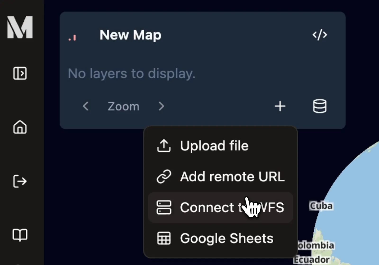
Section titled “Add layer from remote WFS source”Once you have opened a Mundi map, in the bottom of the layer list, click the Add layer source (+) icon. Then, from the dropdown, click Connect to WFS.

Configure the WFS Connection
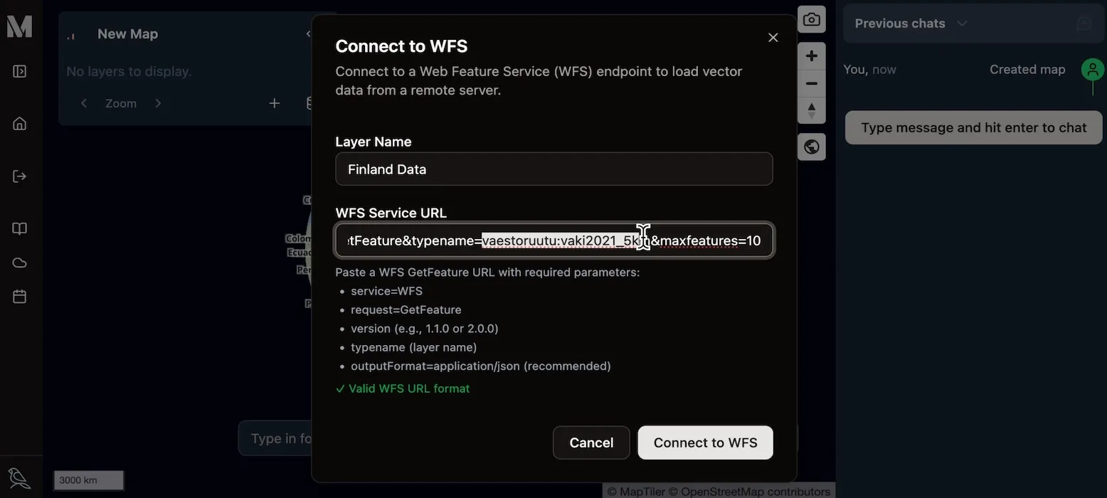
Section titled “Configure the WFS Connection”The Connect to WFS dialog requires a name for your layer and a specific URL to fetch the data.
- Layer Name: Enter a descriptive name for the layer, this will appear
in the layer list. For this example, we’ll use
Finland Data. - WFS Service URL: Paste the full WFS
GetFeaturerequest URL into this field. This URL tells the remote server exactly which dataset you want to access.

Understanding the WFS GetFeature URL
Section titled “Understanding the WFS GetFeature URL”In this demo, we’re using https://geo.stat.fi/geoserver/wfs?service=WFS&version=2.0.0&request=GetFeature&typename=vaestoruutu:vaki2021_5km&maxfeatures=10 as our WFS URL.
This is slightly different from most WFS configurations, because most implementations
of WFS ask for the GetCapabilities URL or merely the /wfs endpoint. Here,
you need to specify precisely which layer you want to fetch using GetFeature.
So in this case, we’re providing typename=vaestoruutu:vaki2021_5km to get a particular
layer from GeoServer. You can ignore maxfeatures.
Once the correct URL is in place, click the Connect to WFS button. Mundi will fetch the data, create tiles for fast rendering, and automatically set up polling to keep the data synchronized with the source.
Exploring the Loaded WFS Data
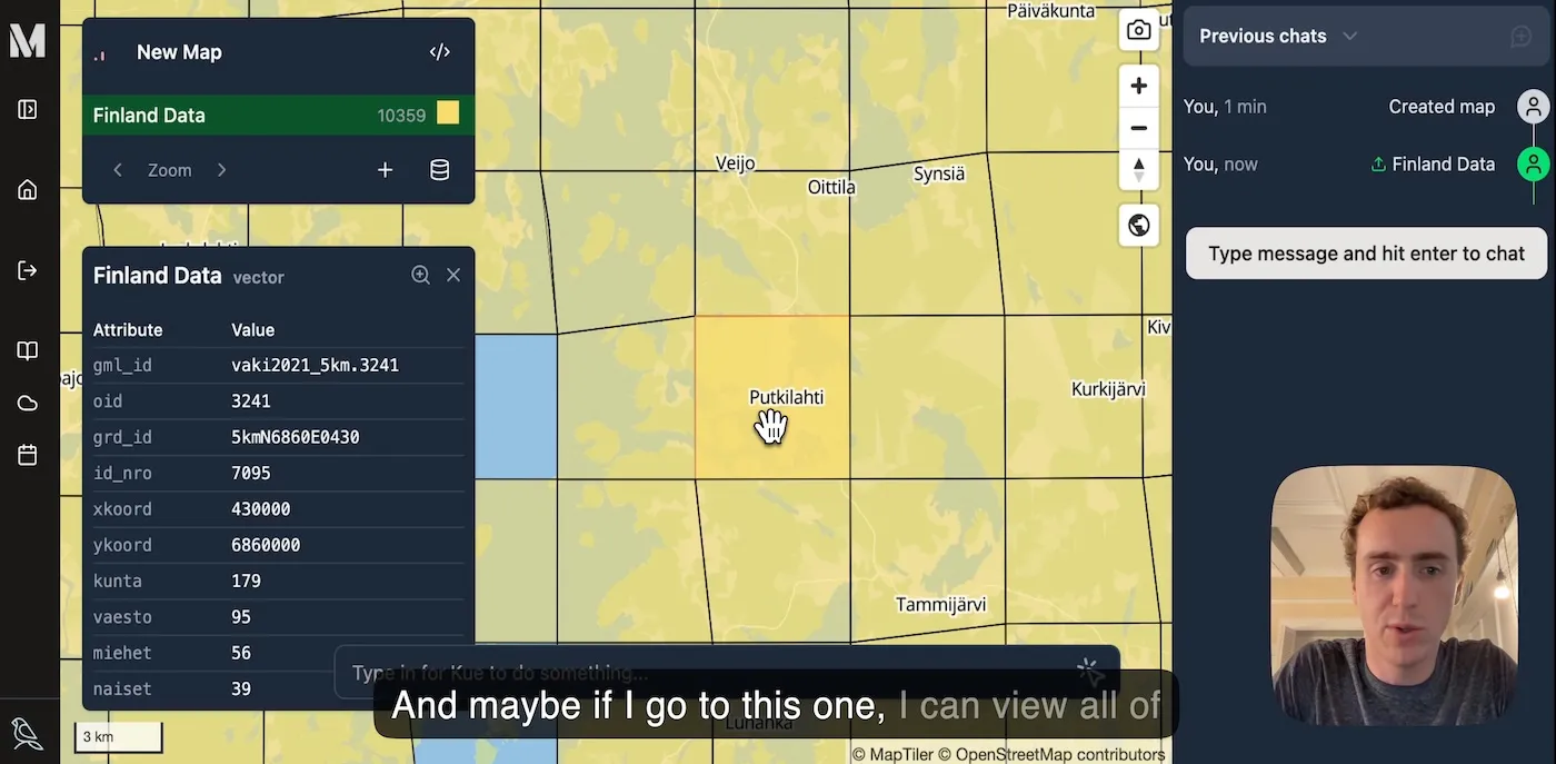
Section titled “Exploring the Loaded WFS Data”After a successful connection, the layer will be added to your map and the data will be displayed.
In our example, a grid of data for Finland appears. The Map Layers
panel confirms the layer has been added, showing a total of 10,359 features and
noting the data’s original Coordinate Reference System (CRS) is EPSG:3067.
You can interact with this data just like any other vector layer in Mundi. Zoom in to see the individual grid cells, and click on any feature to open a popup displaying its attributes.

For further education, a good resource for trying out this WFS server is the Gispo tutorial on WFS.